Four Corners - California to Colorado

by

John and Lynn Salmon -- September 2009

LOS ANGELES (September 10-12)

It begins with "And God Created Great Whales," a piece by a artist/composer/performer Rinde Eckert. We've seen most of Rinde's plays/operas over the last 25 years, and upon seeing a reprisal of his Moby Dick Opera scheduled for John's birthday it seemed well worth a long weekend getaway to catch this one we missed. Of course, once we planned to fly cross-country and rent a car and drive from California to Nevada the trip took on a life of its own and grew to encompass a three week tour around the Southwest visiting 
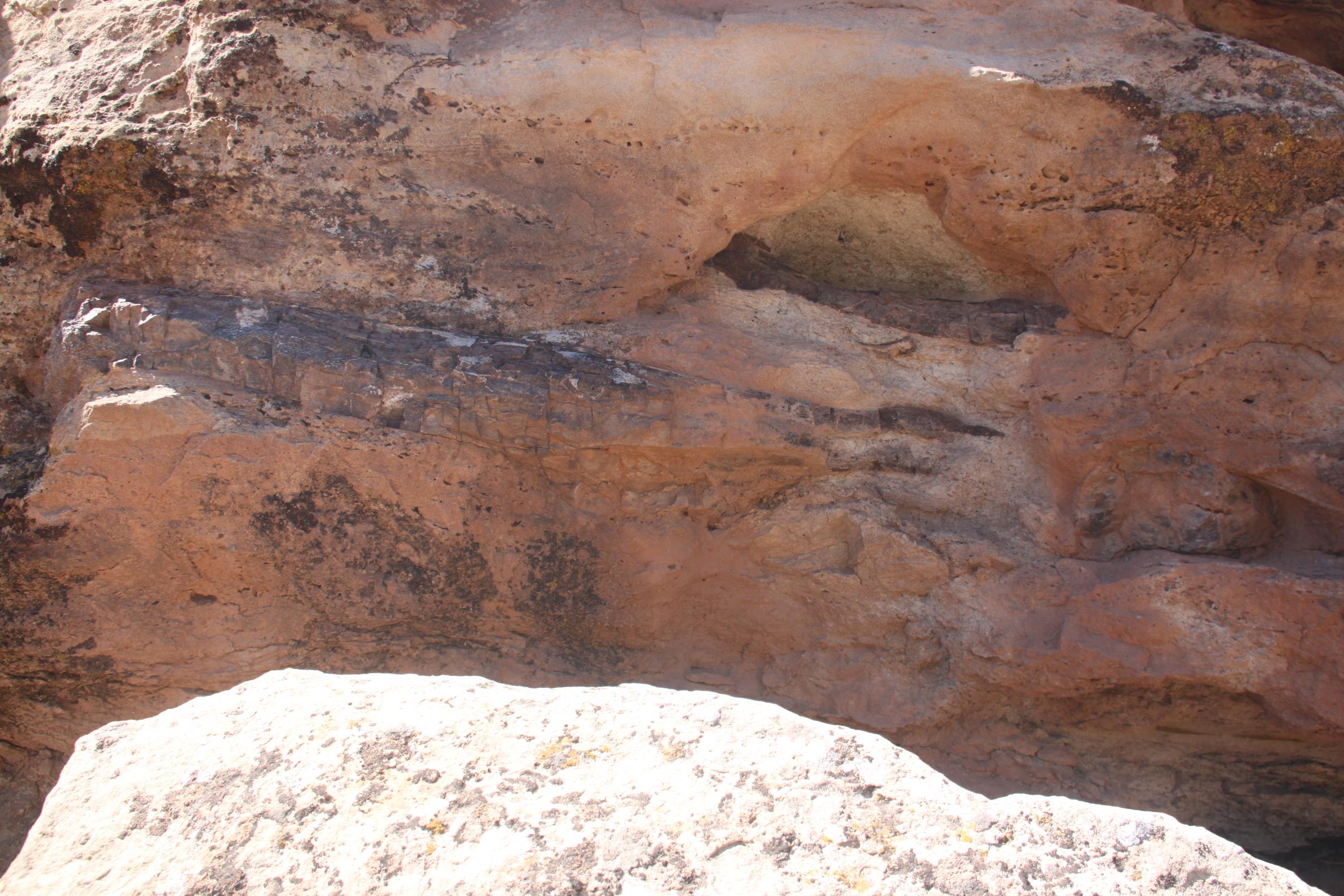
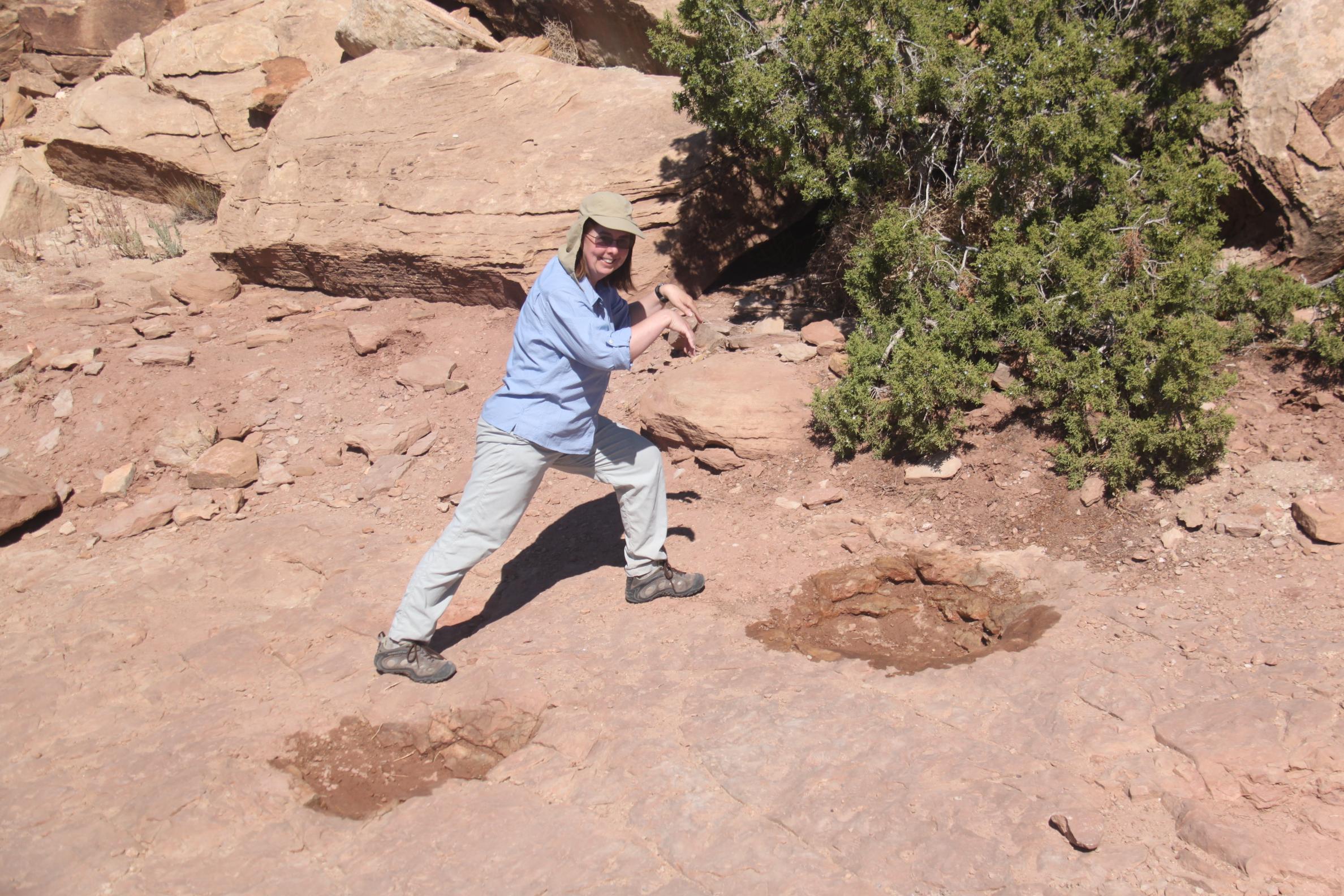
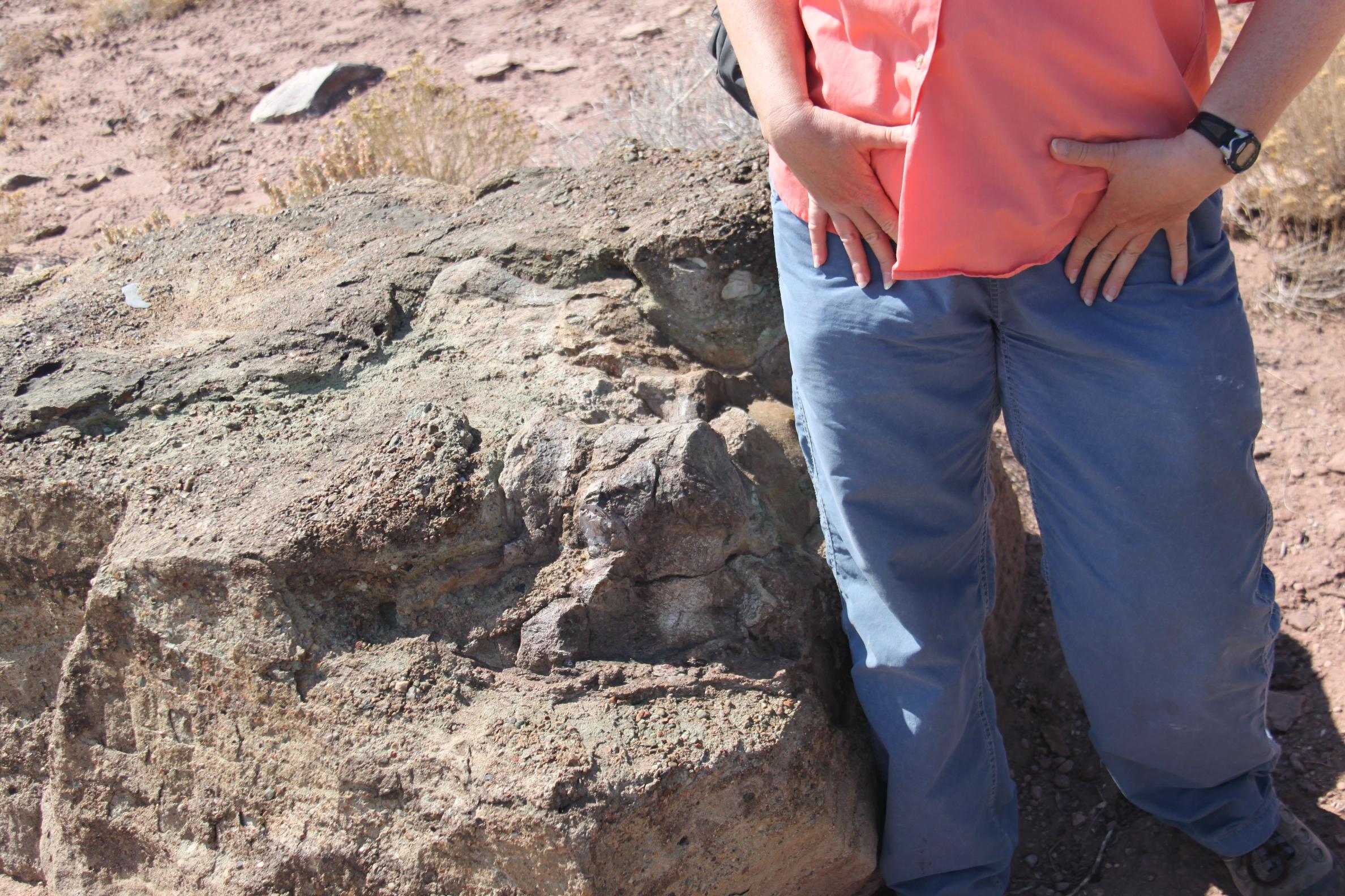
states of the Four Corners, the Navajo Nation, a world heritage site, and some dinosaur sites.

Everything goes smoothly as our SW vacation tour kicks off with a flight to LAX. Our flight departs on time and even gets into Burbank a little bit early. John gets the checked bag, while I get the rental car, one of the quickest car rental checkouts in memory. We take our rental and test out our new Garmin Nuvi gps on our way to the Bonaventure in downtown LA. It's classic LA as we stop-and-go on the freeway in rush-hour traffic. The device decides to re-route us on surface streets and we head thru Chinatown behind a bus. It's not really as bad as it sounds, but we do arrive at the hotel a bit frazzled and tired. The GPS also directs us to the wrong side of the building and we had to go around the block to find the parking entrance. Whether that is the fault of the gps device's database or what info the hotel provided as its street address is unclear, but this sort of thing happens several more times during our trip and we generally don't like the Nuvi as well as our old Cobra GPS.

Aside: review of the Westin Bonaventure -- From the outside the building looks great, at least from a distance. Close-up it's a rather featureless block of concrete with little eye appeal for the pedestrian at street level. We still get a thrill from the glass elevator ride up to our room and later ride up and down in most of the elevators to check out the various views. Our room is on floor 29 with a view down toward the attractive Central Library. As cool as the elevators are, getting to them is a bit like shoots and ladders. Come in from the street and you find yourself on level 4 and must go up to 5 or down to 3 before being able to get an elevator up. Other than the prime downtown location and cool elevators the Bonaventure has little to recommend it. It wasn't a bad hotel, but there were a number of nit-picky things wrong with the room from a burned out light bulb to the wireless Internet not working that would keep us from choosing to stay there again. Plus all of its restaurants close at 9:30pm!

On the other hand, it was great to stay in sight of the USBank building which we saw prominently from our former house on Taos Road in Altadena. And we were able to walk to dinner at the Cafe Pinot across the street next to the Los Angeles Central Library. Yes, we walked to dinner instead of driving, in LA! For dinner, we chose the 3 course tasting menu which ended up with an outstanding appetizer, a good entree, and dessert no to my liking. But that's what happens with tasting menus. Sometimes the chef surprises you with something you wouldn't otherwise have tried that is outstanding. Other times your left thinking you should have ordered the rabbit and the risotto.

Friday, September 11 is John's birthday. I woke really early and, before breakfast, decided to go out and look for the Its All in Los Angeles puzzle cache container with John in tow. It was an inauspicious beginning for the day, with the GPS having as much trouble with the tall buildings in LA as it does in NYC. After a bunch of futzing about without finding the container I gave up and we returned to the hotel for breakfast. At $22 the breakfast buffet seemed a bit pricey, but it was excellent. The orange juice was fresh squeezed, the eggs to order came timely, coffee was replenished regularly and we were very happy with breakfast.

From here our day went fairly smoothly. We got out early enough to walk around downtown LA for a bit before the heat set in and drove us indoors. We mostly toured some of the downtown art work and picked up a few easy geocaches. John busily tested out his new digital camera and we have some classic Salmon shots like the movie of the ground.

Geocaches found included GC1JVQR hiding behind the AT&T sculpture on Hope and Grand. My few walks around downtown LA back when during a 10 days stint of jury duty never got down far enough to see this interesting piece. It features a map of the world and a lot of technological bits from old telephone switches and the like. It also has what I assume is a foreign addition of a Toyota hubcap, that somehow seemed to belong.

We ambled along and found ourself at the top of Angel's Flight. It is still closed for renovation and has a sign saying it will be done later in the year but that sign was dated in 2007. Our walk continued past the Sister Cities sign post near City Hall at 1st and Spring. Shortly thereafter we were overcome with thirst and heat. We found water in the Hall of Records and then went to find a cache at the Court of Flags on Hill. A number of cop cars were parked with engines running right next to the cache, but no one was inside any of them. The cops appeared a few minutes later with their K9 units who could return to air conditioned comfort.

Next stop the MOCA. The MOCA was pleasantly empty inside. Empty of people. There's not really a lot to see when compared to the MOMA, but having the Rothko room completely to ourselves was an enjoyable interlude. There was also an excellent collection of photos from 1955 which reminded me tremendously of my mother's old photo album. There was such a sense of familiarity with the photos that I kept searching for recognizable faces in them. We really wanted a cafe about now, but unfortunately the cafe at the MOCA was closed for renovation.

Feeling like New Yorkers we grabbed a cab and head to Philippes. It was a smart plan but the driver didn't know the place and asked if it was new. Although the restaurant dates from 1908, it's only been at the current location since 1951 so perhaps that could be considered new. We feared it may have closed, but were pleased to find it just as we remembered. It was actually a lot less crowded than we remembered. And we were there at lunch time today, but the huge lines were absent. There was still a fair bit of business, and the French dip was great.

We walked from Philippes to union station and got the subway back to near our hotel. Subway rider-ship was up compared to a few years ago, but still uncrowded. Returning to the hotel, we walked passed the red sculpture outside the Drago building on Figueroa. We noticed this sculpture in the season 1 finale of Heroes on TV. At the time we said, "Hey where is that, I've never seen it in NY" and that's because it's in LA. We didn't have much time to photograph or look for info sign-age on the spot since a security goon decided to rudely run us off the property claiming that the entire block, even the sidewalk was private property and no cameras with BIG lenses were allowed. My point and shoot was okay, but the real camera was strictly verboten.

We relaxed a bit before heading out to see Rinde and the operatic Moby Dick. The piece was excellent. Perhaps Rinde's best, and we've seen how many now? Rinde also talked to the audience after and I was sitting next to the lit professor who organized the show and has his own Melville inspired work premiering April 1, 2010.

The next morning, we had the buffet at the hotel again and then drove to the Petersen Automotive Museum in Beverly Hills. When we first began putting up web pages back in 1994 there weren't a lot of other web sites out there, but the Petersen was one of the early ones and I had a link to their web site for years. However, we never visited the place in the 20+ years that we lived nearby.

It was a great place and our visit was greatly enhanced by tagging along on the tour that was starting just as we arrived. The guide was thoroughly knowledgeable about stuff and had a good clear LOUD speaking voice that could be easily heard. He also pointed out a lot of details that we probably would have overlooked if we had just 
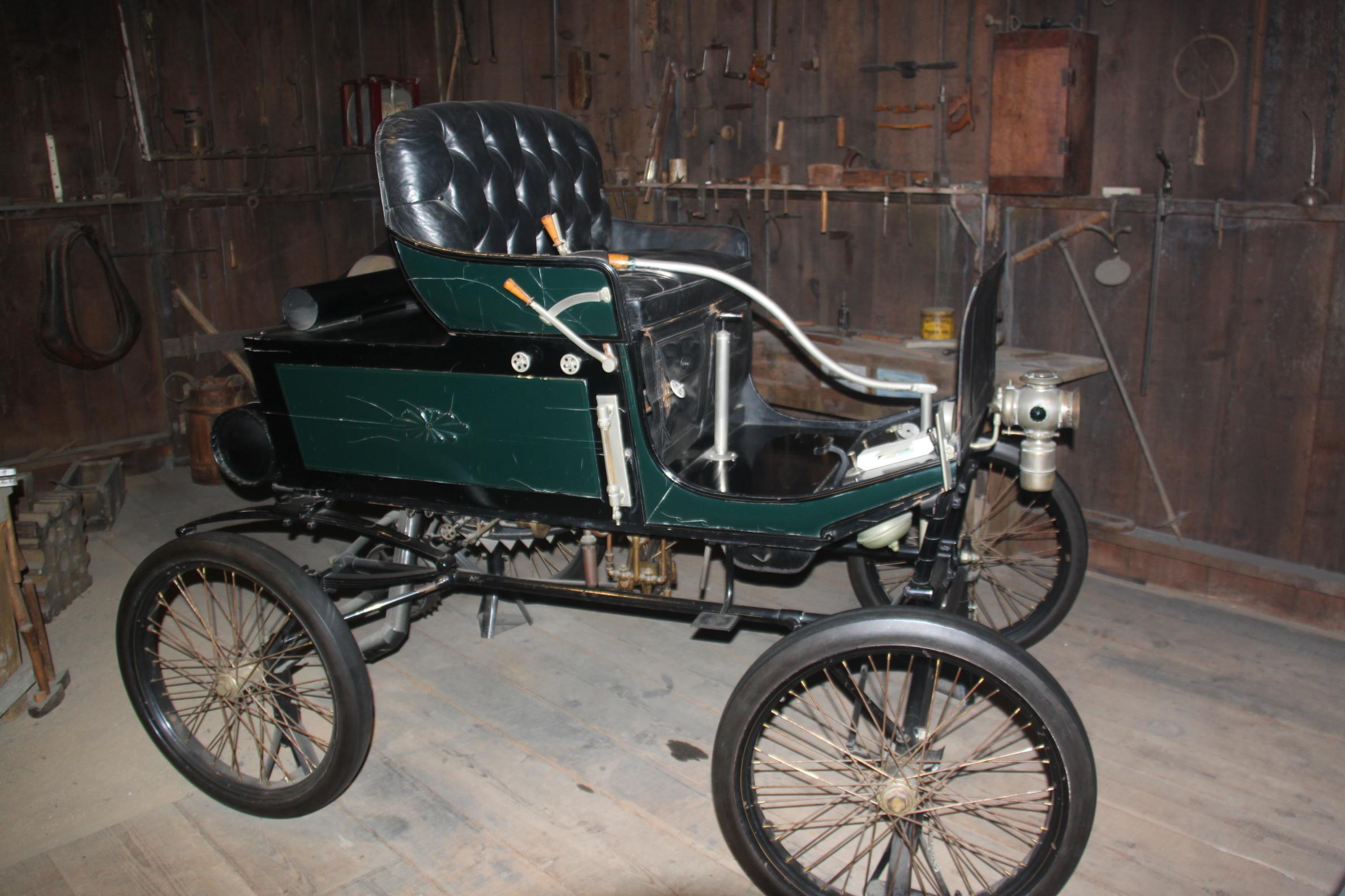
blundered through on our own. Like the bit about the guy who built the early steam car/wagon and then went to Caltech and on to work at 
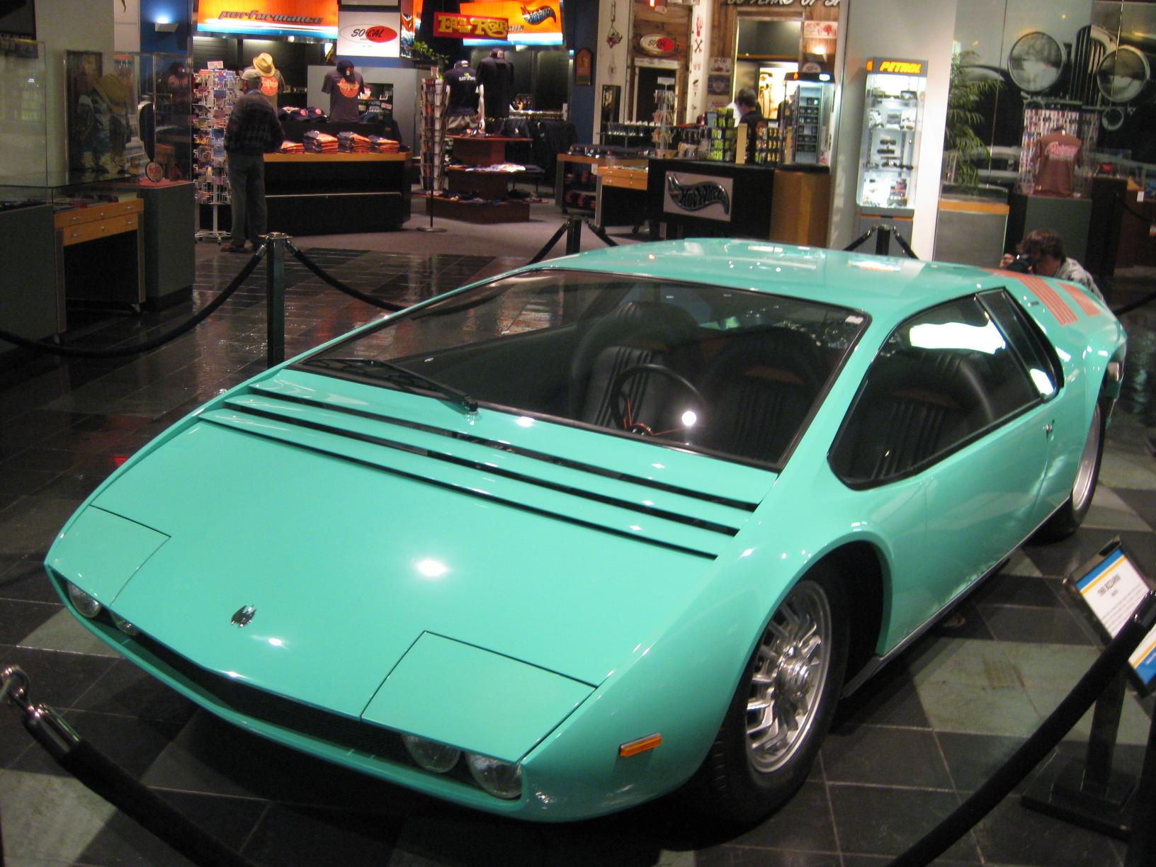
Chrysler. Saw some cool and some weird stuff including the '57 Studebaker-Packard Astral. The Astral was a full size mockup of an atomic-powered vehicle that would have been able to hover at low altitudes over land or water. It would also have a "protective curtain of energy" around the vehicle to prevent collisions. But since no small nuclear reactors existed at the time, none were actually manufactured for sale.

Safety first was not on the minds of the French when making the Helicron in 1932. This propeller driven auto had an unfortunate habit of slicing up pedestrians who inadvertently came into contact with its spinning prop. It also generates so much noise and draft that occupants must wear goggles and headgear for comfort. Of course, it was built to last, and the car shown in the Petersen remains fully operational and is frequently driven by the current owner. The Hollywood section included one of the Bat mobiles along with General Lee of Dukes of Hazard and one of the cars from the movie Gumball Rally. We'll have to add that to our Netflix queue.

After spending a couple hours at the Petersen we headed to Pasadena and lunched at one of our old regular haunts, Saladang. It seemed unchanged after 5 years, and we ordered more or less what we used to always get on our weekly lunch visits. Next it was up, up up we go to the top of Fair Oaks and our old neighborhood on Taos Road. On the way, we stopped off in Oak Park for a quick geocache and got a good look at the recent burn area in the mountains and the new fire breaks. The old house looks pretty similar. They have painted it a slightly lighter shade, only surprising in that I had just had it painted the month I left and wouldn't think a new paint job a priority. But maybe they find beige preferable to light brown.

We also drove by our other previous property and almost didn't spot it behind the new pine tree in the middle of the front yard. I guess it adds to the privacy of the large living room window, but at the cost of what I regarded as the house's best feature -- the view out the front window to the mountains. I had even arranged furniture to take advantage of the view.

LAS VEGAS (September 13-14)

After our trip down memory lane, we hit the road and drove to Las Vegas stopping only to get coffee at the Mad Greek in Baker. It's been 5 years since we made the LA to Vegas drive along the I-15. It used to be something we did a few times a year from 1994-2004, but I think this is the first time we made the trek without encountering slowing for road construction along the way. It was also the first time we stopped at the Mad Greek which we liked. It was 104 degrees at 7pm at night!

At our hotel, the Fitzgerald in downtown we were initially dismayed to be given a smoking room. All the non-smoking rooms were full and we were too tired to go to the effort to move somewhere else so we just stayed put. We stopped noticing the smell after about an hour and have since come to the conclusion that it is a great room. At least it has a fantastic view to both the north and west, we're on a corner with a wrap around set of windows. We are right over the Fremont experience which does add noise, but most of the outdoor noise is drowned out by the room air conditioner. The room was dirt cheap and in the end we were able to overlook it's flaws and appreciate it.

On Sunday, we took a morning stroll down Fremont street until it started looking dodgy. The pimps and hookers hadn't yet gone to bed in these tough economic times. We greatly enjoyed the Neon Museum pieces that have been put along the street.

We escaped the smoky Fitzgerald in favor of breakfast at the Golden Nuggett, which had an interesting looking slide through a shark tank but no one was doing it. After brekkie, John played poker while I did some geocaching and visited Palm cemetery to look at my parents' niches. It had cooled to 97 today. That's a dry heat, so you feel more like you're roasting than braising. Still I traipsed around a bit looking for geocaches.

It was cooler in the evening so we checked out the Fremont experience before and again after dinner. Besides the usual light show with canned music we watched what appeared to be some type of reality or talk show setting up to be filmed in the middle of Fremont Street. There were 9 guys with "crew" badges on a couch and a number of other folks with tape and walkie talkies adjusting the lights. Exciting stuff.

We didn't have big plans for activities while visiting Vegas. It was mainly a way-point on the way to Sedona with the intention of paying respects to my family's resting places. We visited Palm Cemetery once more in the morning before heading out of town. Our drive took us past Hoover Dam which had a big new bridge getting built. We've visited in the past and chose not to stop. On to Boulder City Nevada where we stopped at the Big Horn Cafe for lunch. We also stopped at a couple of virtual caches including the one with the big wheel and a small art park with an obelisk sculpture called Reflections. There was a lot of other art around the twee part of town including a musical staff that looks different from different angles.

SEDONA (September 15-17 )

It took about 4 hours more to drive to Sedona. The scenery began to change from rolling mounds of rubble to pretty ponderosa pine forest as we gained elevation, topping out around 7300 feet in Flagstaff. The route into Sedona along 89A was spectacular and we wished we had seen it with more daylight. We stopped briefly and tried to photograph some elk by the side of the road, but in retrospect we think they were mule deer.

We arrived at the Baby Quail Inn around 7pm and checked in with the friendly proprietors. The woman from the Baby Quail recommended the Barking Frog for dinner. How could we resist a name like that? We learned that Baby Quail proprietor, Dick Curtis, was a character actor in things like the Mary Tyler Moore show and Love Boat. He said he was 82, but we would have guessed him to be in his 60's.

Balloons, Balloons, Balloons

We got up very early for a sunrise balloon flight. We were collected promptly by Doug, the owner of Northern Light Balloon Expeditions, a few minutes before our 5:40am scheduled pickup. We picked up Patrick, the chase-car driver and ground support crew guy at the Safeway parking lot, and then turned into a "condo" timeshare development to pick up the other four passengers who would be joining us for our dawn flight. Doug, our pilot, driver and owner of the company said something about the timeshares all looking "funny". Apparently they had to work around some zoning limitation, so technically they're all mobile homes or something. We didn't get a good look at them to see what was funny. The other four fliers were (roughly in order of talkativeness): a big retired guy with a bum knee, a woman who works in a bio lab, a woman who works for the social security administration and her friend.

It was a very efficient operation. After a short drive to the Coconino Forest area, Doug and Pat quickly began the inflation process. The company owns a few other balloons and teams were setting up 3 other balloons at the same time. First, Patrick jumped out and dragged the basket off the back of the trailer, and with help from Doug, tipped it over. Then he unrolled the balloon itself from its bag, attached the balloon with O-rings and heavy-duty D-rings to the basket and started filling it with a generator powered fan. The balloon takes about 20 minutes to inflate Once it is mostly full of "regular" air, the burners are fired and hot air quickly causes the balloon to want to take off.

We passengers are advised that we should load ourselves quickly to provide ballast. We hop in, which requires scrambling over the sides of the basket which proves slightly difficult for our rider with bad knees, but he is pushed and pulled by the rest of us till we are all squeezed into the basket. There is no "door" on the basket. Doug says that they've been tried, but have never gotten FAA approval. In a "wind landing" you don't want things popping open. The basket is wicker and bamboo (there's a steel reinforcement underneath so the structural elements are all steel cable and solid steel). Doug says that wicker is lightweight, strong, inexpensive, easy to repair and looks good. High-tech materials have not improved on it. Six passengers plus Doug the pilot fill the basket floor completely, but we each have a spot by a rail and can turn around to look out the other directions. Pat remains on the ground with the pick up vehicle to meet us wherever we end up setting down.


Up we go - very quickly at first. Before you know it, we're at several hundred feet. The sun isn't quite over the rim of the valley yet. The other three balloons in our group are up within a minute or two, and our armada is drifting slowly south. The propane jets are HOT. Usually Doug runs them for only a few seconds at a time. Occasionally, he runs them for 10 or 20 seconds and it's clear why they recommend a hat as suggested clothing. You could easily get a "sunburn" (radiant heat burn) on the top of your head. We're told we can grab onto anything in the basket EXCEPT the propane hoses and the propane controls. There are two completely redundant tank, hose, and burner assemblies. Only one is necessary for operation. The other is just a spare.

Doug's got the slightly warbly "old timer" voice of the old Pepperidge Farm radio ads. He tells a couple of stories which he punctuates with a blast from the propane jets. Of the Wrigley ranch/mansion - "... it's for sale now. And probably will be for a while" "at 32 million dollars". We see John McCain's ranch in a valley. I wonder if he had become president whether balloon flights would have been curtailed.

We drop down to maybe 50 feet above the ground to look for wildlife. No javellina or other exotics today. We pass a large red-tailed hawk in the air and see a couple of deer (or maybe baby elk). I only catch a very brief glimpse of one running away. Some cows are grazing at the Sedona municipal water treatment plant. Apparently some kind of municipal boondoggle that was meant to process 1M gallons per day. When it became operational, it topped out at 160k gallons/day. The city had to do a deal with the forest service to spread the rest over a few hundred acres, which they do with giant sprinklers (water cannon).

Up and down we go. We feel wind a couple of times as we transition between different layers of air that are moving in different directions. Otherwise it's completely calm, except for the occasional blast of propane. We hear some Harleys roar by on the 89A a mile or so away. The balloon is pretty responsive to controls -- at least for up and down. A blast from the jets takes a few seconds to take effect and then lifts us pretty quickly. Descent is controlled by opening a rope-connected flap at the top of the balloon. Again, it takes a few seconds and then is fairly quick.

There are no controls other than up or down, and our ultimate landing spot depends solely on the wind direction. We had enough control to come down to maybe 10ft, get a good look at the rocky ground and decide to pull up and try again 50 yards away where Doug set us down very gently next to an agave plant. Packing up was as efficient as setting up. The balloon gets rolled into a bag, tipped onto the trailer and we're on our way. All four groups of passengers meet up at a turnout/parking lot and have a champagne breakfast. One of the pilots tells a story about the early French balloonists who brought champagne along so the farmers whose fields they landed in wouldn't burn them as devils and witches. This somehow explains why ballooning and alcohol always go together.

Palatki Ruins and Jerome

Our ride took approximately 1 hour and we went a few miles. We found ourselves back at the motel with our whole day still ahead of us. We have second breakfasts at the Coffee Pot (restaurant, not geologic feature), and then head on to Palatki Ruins. We had to call ahead to make a reservation. When we got there we weren't the only ones who had called, but it wasn't completely clear why we had to call. I guess it's sometimes not fully staffed -- there are three rangers -- one at the ranch house, one at the cliff dwelling and one at the pictographs.

Visitors get personalized tours from the rangers. There are generally only a couple of visitors at a time. We are told repeatedly to be very careful not to touch the top surfaces and not to hold onto the walls for support. Two of the three rooms at the dwelling are currently closed because some cracks have formed in just the last few weeks and they're worried about instability. They're waiting for the archaeologists/engineers to come check it out.

There's a short steep trail up to the cliff dwelling and a slightly longer trail to a set of pictographs on a rock overhang nearby. The Sinaqua people lived here roughly from 1100 - 1400 AD. They probably learned about building cliff dwellings from the Hohokam, who had been doing it for a few hundred years before. The entire valley was under cultivation. Something like 60-80 people would have lived in the cliff dwelling at Palatki. The petroglyphs are much older with some estimated to be 5,000 to 6,000 years old. Nothing at this location has been rebuilt or restored. It's all exactly as it was found in the late 19th century by a Smithsonian expedition.

When we finished viewing the cliff dwelling, Charlie, over at the pictograph site, had finished his lunch. The rock art site is all clearly accessible and Charlie from the NPS was a pleasure to talk to while we looked at the drawings. The site also has the remains of a tin shed and chicken coop from a 19th century settler. Charlie lives in Cottonwood and highly recommends the Tuzugoot pictograph site as well. The V-bar-V site is even more spectacular, but is only open Friday to Sunday, so we won't get to see it. Charlie highly recommended a book by one of the officers with General Crook's expedition to the area. Something like "On the border with Crook". The pictographs in this area range from a few thousand years old to "historic". The obvious historic ones show men (Spaniards) on horses. Charlie was pretty impressed by the toughness of the Spaniards - riding across the Sonoran and Arizonan dessert with full battle armor.

Near Palatki, we drove a few miles west on dirt roads. The car was just covered in red dust. We made a short detour for a geocache that's been out since 2001. After the find, we continued along dirt roads eventually making our way through Cottonwood and heading up to visit the old copper mining town of Jerome where we lunched at the Haunted Hamburger. Jerome is perched on a mountain side above an open-pit copper mine and is an odd mix of boutiquey galleries and remains of early 20th century artifacts.

The mine closed in 1953, and the population fell to about 100. Subsequently, the hippies showed up followed by the tourists, so the population is now over 1000. Jerome has the usual assortment of new-agey tourist shops, with an additional "ghost/haunted" mix thrown in because of its ghost town past. The historical society's museum was definitely the high point and well worth the $2 admission fee. It contains historical photos and info about the time-line of the town along with a few quaint artifacts like some CSI implements from the 1930s, an interesting Chinese laundry machine, and some historical photos relating to the local town high school. They're known as the Muckers.

We took a timeout for espresso at the Marmalade Cafe before heading back to Sedona via the Red Rock Loop Road. It's a short scenic drive with some excellent views of one of the vortices, Cathedral Rock.

After napping we get up a bit late for dinner. Recalling that last night's dinner place had a sign that said it would be open till 10pm, we head over at about 9:15. It's pretty empty -- even the bar is deserted. Nevertheless, they are happy to serve us a very nice French Dip. When we leave at 9:40, the sign that says they're open till 10 had been taken down :-).

Bell Rock and Courthouse Butte

We had some trouble getting started because of communication issues. Once we found the geocache up by the airport and took suitable pictures of Coffeepot Rock, communication improved and we headed to a section of red rocks that we haven't really seen yet. Bell Rock and Courthouse Butte are south of town on the 179. We look in at one trail head, but correctly judge that most of the views from the trail leading away are similar to what one sees from the highway. So we take the trail head next to the Circle K, and start on the Bell Pathway and did what was advertised as a 4 mile loop hike around Bell Rock and Courthouse Butte. It took nearly 3 hours with stops so may have been a bit longer.

We weren't sure how the heat and sun would affect us, so we brought lots of water and wore lightweight long pants and long sleeve shirts and hats. We walked the loop counterclockwise starting on the south west side of Courthouse Butte. We had great views of both CHB and Bell Rock for the entire walk. Lots of sun, but there were enough Pinon trees to provide enough shade to allow you to sit and take in the view. After a mile or so we drop down into a not-quite-dry wash and pass the sign that says we're entering the wilderness area (no bicycles). The vegetation is slightly different here, and there is some sign of recently running water - there's even some water in pools in the slickrock. As we round the east side of CHB we run into a bunch of hikers heading the other way - all of whom ask for reassurance that the parking lot is really this way. We assure them that it's about 2 miles, which isn't exactly what they wanted to hear (at least the first ones). The second couple wanted to know if we had detected any anomalies with the compass, and the third guy was happy enough just knowing he really was on a loop trail.

This was a great hike. We finished our water about half a mile from the end, when we were back on the heavily traveled Bell Pathway. We were pretty exhausted when done, but stopped at the Safeway on the way home. Lynn spent a very long time in a fruitless search for horse-radish cheddar. I would have preferred to lie down. When we got back to the hotel we had to change rooms because our late change-of-plan to stay an extra day required some room rearrangement. We snacked on croissants and yogurt, and then slept till dinner.

Dinner was at Kurt's Bistro, which was excellent. The corn soup was the high point. I had veal with sweet bread ravioli, both of which were excellent. Lynn had the salmon, also excellent. No room left for dessert.

Holes in the Ground and Standing on a Corner (September 17)

The Baby Quail Inn is lovely, except for the wireless internet. It works just barely well enough to keep you retrying, over an over, with a couple of minutes of timeouts in between each success. We took a while getting going this morning as we dithered about what to do -- lava tubes north of Flagstaff? Montezuma's Castle south of Sedona? Montezuma's Well?

We set out to visit Montezuma's Castle but because both Montezuma Castle and Montezuma Well are part of the Montezuma Castle Monument or GPS directed us to the Well which is 11 miles closer. This turned out to be for the best since the well is a cool relaxing oasis in the desert. A few miles over well-maintained dirt roads brings us to a natural spring in the middle of the desert. There are a few dwellings around the outside of the depression and some hundred-year-old graffiti/advertising. Is that real graffiti from 1896 advertising someone's paintings? We were able to walk down into the sink hole and get a closer look at the cave dwellings. The water drains out of the well through a "swallet", emerging on the other side of the wall into an irrigation system that had once been used by the inhabitants, but now just keeps the path dry. There's some nice shade at the bottom of the hole, but all in all, we're much more done in by the sun today than yesterday, even though we're out for much less time. We're wearing short sleeves today, which might make the difference.


Back on the road, we drove through Flagstaff and then on to our second big hole in the ground at the Barringer Crater. Meteor crater is a few miles south of I-40. When we get there, we discover that John doesn't have his primary credit card. This casts a shadow over our visit. There's not really much to see at the Meteor Crater and the $15/person price seems a bit steep. They've done a nice job with the museum, and it's definitely several notches above a "roadside attraction". The scope is fairly limited (meteor impacts, geology, history), but the information seems accurate and the displays are the quality you'd expect from a good science museum.

Unfortunately, (or maybe fortunately, who knows, 2.5 more miles in the sun might not really be what we needed), we miss the 2:15pm guided rim-walk, so we just get to see the crater from the four overlooks at the visitor center. When we're done, we carefully go through our receipts and determine that the missing credit card must be at either the lunch place in Jerome or the Barking Frog. We call the Barking Frog first, and sure enough - they have it. This is a big relief, and we ask the woman there to cut it up and throw it away and we'll get a replacement when we get home.

We continue onward along the I-40 which is on top of sections of historic Route 66. We stopped at Meteor city to take photos of the longest map of Route 66 painted on a wall and then pulled off at the exit to Leupe and find a rodeo practice happening. We later learned that a rodeo is coming to the area next week, but we get to sit and watch about a dozen guys practicing their roping at the Diamond B Livestock pen area just off the freeway. We were the only spectators.

Back on the road to Winslow - home of the corner boys, aka a famous corner roadside attraction along Route 66. Winslow Arizona has made a small park in homage to the lyrics from the Eagle's song "Take It Easy" (lyrics). We find a Crazy-Heart character chatting to someone by cell phone while trying to determine the identity of the statue on the corner. We agree that it's probably Jackson Brown. That seems to satisfy both him and the party on the other end of his cell phone.

We did our own share of Standin' on a Corner photo snaps then walked a couple blocks in search of another geocache, which took us to the Posada hotel with its fancy Turquoise Room restaurant. They can't seat us till 8:15, so we leave, but then we decide to look for a place to stay in Winslow rather than carrying on to the next town so we can eat at the Posada - allegedly the best food between Las Vegas and Albuquerque. John's soup was excellent, and two out of three of the Wild-Wild-Wild Sampler Platter (quail and elk sausage) were excellent, while the wild boar was tough. Lynn's native cassoulet trio sounded better on the menu. The lamb was good, her elk was surprisingly spicy (not bad, but surprising) and her duck was overcooked. Verdict - a little better quality control and it would be a great restaurant. La Posada was the last of the Harvey Houses built in 1930 at a cost of 2 million dollars when Winslow was expected to become a tourist Mecca. It does boast a large collection of photos of "famous" guests adorning the walls near the restrooms. We recognized some of them and noted Willie the wonder dog among the patrons, but we have no idea who Willie was.

Petrified Forest (September 18)

We drove through Holbrook on the way to visit Petrified Forest National Park making a brief stop at one of Holbrook's historic Route 66 icons, the Wigwam Motel. After all, who doesn't want to sleep in a concrete replica of an Indian teepee. We had actually intended to make that our destination last night, but opted for fine dining over wigwam sleeping. The place did look cool with a bunch of vintage automobiles that they keep parked beside the wigwams.

We spent the rest of the day in the Petrified Forest National Park. The park contains the petrified remains of trees from the Late Triassic period (225 million years ago). The uplift and erosion of the Colorado Plateau over the last 60 million years created the Chinle Formation. This rock formation includes the Painted Desert known for its red hues and the blue tones of the Blue Mesa area.

We entered at the south entrance and gradually made our way through the park from bottom to top. The park is large. The drive along along the main road is 28 miles from one entrance to the other (map). There are numerous places to stop along the way where 1-2 mile loop hikes allow you to see a bunch of park features.

We began at the giant logs trail where some of the largest specimens remain, including one known as "old faithful" that is nearly 10 feet across at the base. We caught a ranger guided walk in progress and listened to a bit of what he had to say before heading to the Crystal Forest area and self-guided exploration. The petrified wood here is made up of almost solid quartz. Pieces look like huge crystals glittering in the sunlight with colors from various impurities, such as iron, carbon, and manganese.

As the name implies, the Crystal Forest area has some of the most beautiful petrified wood pieces in the park. The logs originally washed into an ancient river over 200 million years ago and were buried deeply in the sediment. Over time, minerals were absorbed into the porous wood and crystallized replacing the original organic material. Some of the trees have fractured along the tree trunk, giving the appearance of logs cut with a chain saw. We were among a handful of visitors taking the 0.75 mile walking loop through the many many many petrified wood specimens in this area. We spotted and photographed a large green lizard enjoying the sun.

Next stop toward the middle of the park up was the Blue Mesa. This 1 mile walk takes you down into a slight canyon to get a good look at badland hills of bluish bentonite clay. The walk is classified as moderate to strenuous. While we didn't find it difficult, we were pleased to be essentially alone for the entire hike. The place was quiet enough to hear a pin drop.

We pulled over at Newspaper Rock which affords a view of ancient petroglyphs. More petroglyphs can be viewed at Puerco Pueblo plus some type of astronomical "crack" was also present. We took a photo with our compass lined up to show something?

Heading out of the north end of the park we drove through the Painted Desert on our way out and caught some far reaching views over the landscape. It was a clear day and according to one sign post we could make out a feature, Mt San Francisco, that was 120 miles distant.

Leaving the park we made the 2 hour drive to Canyon de Chelly and checked in at the Thunderbird Lodge located in the park. We went to dinner thinking it was 7pm but it turns out that while Arizona does not recognize Daylight Saving time, the Navajo Nation does so it was 8pm and closing time. We were just in the nick of time to get fed.

CANYON DE CHELLY (September 19-21)

Canyon de Chelly rim drives and White House Trail

Canyon de Chelly National Monument includes a large swath of land through three major canyons that were cut in the sandstone by streams with headwaters in the Chuska mountains just to the east of the monument. We found it more beautiful than the Grand Canyon, possibly due to the sparsity of other visitors cluttering up the vistas. It consists entirely of Navajo Tribal Trust Land owned by the Navajo Nation. Access to the canyon floor is restricted, and visitors are allowed to travel in the canyons only when accompanied by a Navajo guide, which are easy to arrange. One exception to this rule is the White House Ruin Trail which allows visitors a 2.5 mile walk down into the canyon. Roads run along both North and South Rims with numerous turn-offs where ancient ruins and geologic structures are visible.

Although we felt we started our day a little late at 9:00am, we seemed to beat the crowds to all the scenic spots along the south rim. Not that there are very many crowds currently at the place, but first thing in the morning we were sometimes the only car, and at most 1-2 others would be at each of the turnouts. By noon there were up to a dozen other cars.

We checked out the various view points like Spider Rock, a very prominent feature which can be seen from South Rim. It's an 800 foot twin spire, that could be described as very spidery (a jumble of spirey and spindly) but is the home of Navajo deity, Spider Woman.

We drove to the end of the pavement along the south rim and then stopped in at Totsonii Ranch to see if we could arrange horse back rides for tomorrow. An article had appeared in the New York Times a couple weeks before our trip singing high praises of the horseback ride down into the canyon offered by the Totsonii Ranch, and we feared that they might be solidly booked. However, we seem to be the only people who have found the way a mile or so down the dirt road after the pavement ends to the ranch and the horse rental. There's another well signed horse rental nearer the Tbird lodge but we heard it was more interested in the money than the customer's experience. We found one friendly guy at the place who assured us he could take us out any time, and Gabriel was certainly willing to take us out right then and there. We instead agreed to come back for a morning ride the next day, time seemed like a flexible concept.

We had lunch and tried the Navajo flatbread (yummy) at the Thunderbird Lodge cafeteria. We found the Tbird Lodge at Canyon de Chelly comfortable enough to add a third night to our stay here. I don't know what made it a great room, it's pretty basic, but we found the place relaxing. The water in the bathroom blasts out super strong and the cafeteria food is filling and easy to get to.

After lunch, we opted to hike the 2.5 mile trail down to the White House Ruin at the bottom of the canyon. It was overcast all the way down, but the sun came out on our way out. The walk advertises steep cliff dropoffs, but the path is several feet wide and didn't feel unsafe.

We still had enough energy after finishing the hike to make the drive along the north rim and see some different canyon views. On the way there, we picked up a Navajo woman named Mary. She was very chatty and shared a long story about visiting family here and needing to walk or hitch to a job in Salt Lake City by Monday. That would be quite a hike! We later realized our rental car had Utah plates, but we weren't heading that way. We tried helping out by dropping her at the Chevron station in Chinle where she would be able to hitch another ride. As she exited the car, she warned us not to pick up any Indians, some of them are crazy, she said.

Canyon de Chelly by horse to Spider Rock

We took horses down into the canyon with Gabriel, our Navajo guide from Totsonii ranch. We got to Totsonii Ranch around 8:45am. Gabriel wasn't really expecting us -- evidently, many people say they're coming back but don't. So the horses weren't saddled when we got there, but Gabriel and Shorty got them ready pretty quickly. The horses were Tex and Lily and Shorty is a guy they found under a bridge who now works the ranch. Some people are better with animals than people.

There's another big group of kids out on a two-night trip so a lot of the saddles are out. There's a bit of grumbling and changing around among the gear that is left. We wouldn't know the difference between a good/new saddle and a bad/old saddle anyway, so this wasn't a problem. We're up and the horses are walking by 9:15.

Gabriel is very relaxed and chatty. He clearly enjoys a day out on the trails with visitors. He talks a bit about the plants, animals, his life, etc. He's 49 and getting a GED so he can drive a bus in the winter when the ranch is closed. His father was one of the Navajo code talkers. He somehow didn't register properly and then didn't get any government benefits when he returned from the war.

We learn a little about using juniper berries (green ones, before they turn blue) for fever. Something in the Pinon seeds, which appear every four years, is valuable enough for people to bother to collect. I'm not sure if it's for eating or medicine. Although the pinon and sage brush looked very green against the red soil, there's been a serious drought the last few years. It's been dry all summer and the Pinon are suffering. The sage is doing better, with 4 foot deep roots, but quite a few Pinon are bare and/or falling over. We saw rain clouds over Chinle two days ago, but they haven't seen any at the ranch. As we're riding there's a bit of water in one of the washes, so it must have rained nearby some time.

We amble along the road for maybe 1/4 mile, then turn on a track into the sage and pinon. We pass a hogan with three mid-sized dogs loudly protecting their property. The horses seem completely unconcerned by dogs. Gabriel says there are no snakes around here.

We amble for about an hour along the rim. There are only occasional views of the canyon. You could easily not know there's a canyon nearby. Flat Top Mountain is in the distance. After the first hour we stop and Gabriel checks up on both us and the horses. Everyone's in good shape. At this point there's no hint of soreness. We have some water and then mount up to head down into the canyon.

It was an awesome ride and included moments of terror as Lynn's horse chose to give her maximum views leaning out over the cliff side as we made our way down the steep trail into the canyon. Surprisingly, I am not panicked by the ride down the canyon. It's very steep and rocky, but the horse is pretty sure-footed. These horses were not shod which we were told made it less slippery for them.

I let the horse find his own way. He seems to like to be back about 10-20 yards from Lynn's horse, which is fine with me. There are only a couple of places where there are precarious multi-hundred-foot drops off the side of the trail. Mostly it's just a steep track cut into a steep, but not sheer, hillside. The sandstone is just amazing. Around every turn there are more layers and colors. Clouds cover and uncover the sun revealing different colors with every turn around the switch back.

From time to time Gabriel jumps down and moves a few rocks to shore up the trail. A little trail maintenance on every trip keeps the trail in good condition. We learn on the way back up that we had taken a new trail that Gabriel built himself on the way down to avoid a switch back that overlooks a deep ravine. "It freaks out too many people. Not a problem going up, but people get scared going down". Lynn is really glad we didn't take that trail down.

For a while I watch a hawk slowly climbing out of the canyon without flapping its wings, hugging very close to the canyon wall, looping back and forth where there must be a weak thermal of rising air. Other than the birds and the clomp clomp of horses feet there is no other sound. There's not enough wind to rustle the pinon and sage brush. We're miles from the nearest road, and it probably gets one or two cars per day. When we get to the bottom, there's no sign of tire tracks, so it looks like the shake-and-bake tours must stop on the far (down-canyon) side of spider rock.

Gabriel points out a couple of ruins up the hillside. He doesn't visit them. A potent mix of Old Navajo mythology and the germ theory of disease is more than enough to keep him out of the old places. There are people buried all over, sometimes there are even skeletons in the ruins. When he was a child, when they got home after playing in an old ruin, his grandma whipped him and then threw all his clothes in the fire. Even the shoes. Shoes couldn't have been cheap. He mentions bacteria a couple of times and doesn't mention ghosts at all -- but he definitely got the message to stay away from the dead.

At the bottom of the canyon the vegetation changes. Oak trees and some other narrow-leafed tree that Gabriel says was planted only a few years ago dominate the valley. We pass a hogan that looks empty but well-maintained. Somebody lives out here at least part of the year.

We stop for photo ops near the base of Spider Rock. We've been riding for about 2 hours now, and still feel pretty good on the horses. It's been cool and calm, and the day has been absolutely wonderful. This is definitely the high point of the vacation so far. The long downhill ride into the canyon was just spectacular.

The ride out shows us the canyon from another angle - every view is different. At one point, my horse takes a side trail up a wash instead of the main trail up the side. Rather than backtrack, he humps up a very steep but very short section. It doesn't really feel unsteady, but it's a little bit of excitement for the way back. I follow "the horse knows best" strategy - he does the quick climb without provocation from me when he sees where the other horses are headed.

By the time we get to the top of the canyon, my legs are starting to tire and my butt is hurting. On the way in, we trotted a few times and I had no trouble standing up and using my legs as shock-absorbers. Now my legs are rubbery and trotting just hurts my backside. Less trotting, more walking. Eventually, I see some power lines in the distance, which means we must be getting close. We get back around 1:30, a little more than four hours.

Gabriel said that the extra trip to Spider Rock was his "treat" - he just really likes being out here and doesn't seem too concerned about whether we pay for three hours or four. He made a point at the beginning of the ride about how different Totsonii is from "Justins" because with Justin you're always on the clock. Gabriel doesn't even wear a watch. We call it a bonus and pay for four hours. Altogether a fantastic bargain - $180 for four fantastic hours in the quiet and solitude and beauty of Canyon de Chelly. The only thing I can't figure out is why everyone else isn't out here. Sure, some of the guests at the lodge are older and wouldn't enjoy a horse ride, but there are plenty of younger, fitter guests as well. Certainly anyone we saw yesterday on White House trail could and would enjoy the horse ride. We can't complain. I just hope that Totsonii is getting enough business to stay in business so they can keep sharing this part of the world.

We returned to the lodge for lunch and a needed recovery period for our legs. We had some good okra with dinner. It was a southern inspired meal with chicken fried steak, called more appropriately beef fried steak.

Four Corners and Salmon Ruins (September 21)

Four states in one day. We began the day in Arizona, drove up and touched Utah, spent the day in New Mexico and ended for the evening in Colorado.

There's not much to see at Four Corners Monument, the only place in the US where four states touch. A plaque has been erected on the ground detailing the meeting point and tourists flock to it to take their picture in various odd poses while touching all four states. People seemed to be having a good time and enjoying each others antics, and the few minutes wait for our turn for a photo-op was very pleasant. We felt it definitely worth the slight detour and $3 admission to visit this unique geographical feature.

We next headed into New Mexico toward Salmon Ruins. How could we not visit Salmon ruins? We stopped for lunch at a roadside diner in Kirkland that had kitchen problems and I ended up finishing my lunch before John's made it out of the kitchen.

On to Salmon Ruins. It had a lot more stuff than we expected. The name comes from the Salmon family (no relation to us) who owned the property and began excavating the ruins in the late 1800s. The ruins at the site date from approximately 1088 AD and include a Chacoan great house and a complex of up to 250 additional rooms. The ruins can be visited on a self-guided tour. There is also a small quaint museum on site with sample relics and drawers you pull out to identify objects and the like. Being named Salmon, we couldn't resist a Salmon Ruin tshirt and fridge magnet at the gift shop.

We continued approximately 20miles north to Aztec Ruins which is part of the UNESCO World Heritage site of Chaco Canyon. We visited Chaco sometime in the 1990s and don't plan to stop there on this trip to the Southwest, but it was nice to visit this companion site which serves as a bit of a bridge between two major centers of ancestral Pueblo culture, Chaco Canyon to the South and Mesa Verde to the North.

Aztec Ruins are a bit larger than Salmon Ruins and there is a great deal of information documenting it available from the park service. The park service was actively doing something involving earthmoving with bobcats which stirred up a lot of dust and marred the peaceful quiet that likely surrounds the area at other times.

We continued to Mesa Verde and noticed a serious weather change-up upon entering Colorado. On entering the state we saw a sign saying chains required Sept-May. Hmmm, we have no chains and were not expecting temperatures lower than about 50 degrees on this trip. Of course, we find ourselves with frost warnings and forecast for a low of 25 tonight. At least our room at the Far View Lodge has heat.

There is one nice restaurant in Mesa Verde. It doesn't take reservations, and everyone staying in the park chose to eat there at the same time, tonight. We are starving, and the loooooooooong wait for a table is agonizing. We were also put off by the slow experience at the lounge upstairs while we waited for a table. We tried to have a glass of wine during our hour plus wait, but couldn't get the wine until our table was called due to the bar being overwhelmed by other waiting diners. In the end, the food at the Metate was good. I had quail, which may have been the best quail dinner I've had in the last 25 years. Not worth the wait or poor service, however.

MESA VERDE (September 22-23)

``It's full of animals,'' John exclaimed as he stepped out on the deck of our room first thing in the morning. He didn't yet have glasses on and couldn't tell that the sage brush outside our window was full of browsers. What kind of browsers, Safari or Mozilla? No, they were mule deer browsing, but we initially misidentified them as elk. Photography was difficult as the sun was just coming up, but the browsers kept at it with no concern for our near presence. We shortly saw flashes coming from other rooms as other guests noticed the animals, and our pictures improved as the light increased.

We will give the Far View Lodge credit for having a great view. Otherwise, it's a basic, but comfortable room. The wifi works first thing in the morning but becomes overwhelmed with more than a few guests using it at once. Breakfast was crowded and dismal. I have to assume the cafeteria was having a problem with it's warming trays as the eggs were more than a little cold.

Fortunately the weather changed for the better. It was still cool but the wind died down. We took the first tour of Cliff Palace available at 9am. You can't get into Cliff Palace without a guide. It was good to go in the morning to be able to photograph the whole place without any people in it before the regular tours start trouping through. Afternoon is the time to go if you want the sun to be on the place while you visit. Our group size was relatively small with 20 people. It's hard to believe they allow up to 60 people on one of these tours since it's a bit cramped in spots. We went back in the afternoon for better photo light and saw the 4:30pm tour only had 4 people, luck of the draw. We had an informative guide, Mark. He was a quiet mild-mannered fellow with a bumper sticker on his vehicle, that read ``obey little, resist much.''

We subsequently took the 11am Balcony House tour. Balcony House is quite something to see and not to be missed. While signing up there are multiple warnings about ladders and physical fitness involved with this tour. The visit begins with a climb up a 10m ladder and later involves crawling on hands and knees out a tunnel. While not wheelchair accessible, it's not really that difficult and none of the 30 people in our group had any trouble. We did hear of a 400 lb man who got stuck in the tunnel, but it could be a bit of fancy. Again one must take a tour. We had dude ranger Jose for a guide who was very funny.

We heard various interpretations of why the cliff dwellers chose to move to the cliff including defense. We favor the water theory since it turns out there were spots where the water collected near where the homes were built. We also got mixed views of the kiva as being strictly ceremonial vs. a great place for the family to hang out by the fire in the evening. We also made up our own personal theory about gas at elevation driving the cliff dwellers away.

After lunch, we embarked on the 2.5 mile petroglyph trail. It was more challenging than the Balcony House tour, but didn't come with warnings, probably due to the many fewer folks who choose to do it. We left the crowds behind after about 2 minutes and enjoyed 2 hours of Mesa Verde to ourselves. The walk ended near the Spruce Tree House, the one cliff dwelling that can be visited without a tour guide.

We had expected to spend more time at the world heritage site, but a second lousy breakfast cemented our decision to leave Mesa Verde rather than stay another night. We would have enjoyed taking a slow and easy day and spent some time reading from our lovely balcony, but poor food can sour a vacation so it seemed best to move on. We made a final drive of the Mesa Top Loop and took the 1 mile Soda Ash Canyon walk for the view over Balcony House first thing in the morning on our way out. No one at all was out on that walk, and it looked like only a handful of folks took the 9am Balcony House tour. One might plan to start with that tour rather than Cliff House as recommended by the rangers.

MOAB (September 23-25)

On the way to Moab, we stopped at the strange and wacky Hole N" the Rock. It's one of those roadside attractions thats hard to describe. There's an eclectic mix of items on exhibit on the grounds including big foot, a statue of a knight, mining implements, a giant lizard and Franklin D. Roosevelt's face carved in the rock. Wacky! It was the home of Albert and Gladys Christensen (the home was carved in the rock over a number of years) and simple stones mark their graves on site.

Moab is crowded, which takes us by surprise, but we get lucky and get one of the last two rooms at the Aarchway Inn. It's a suite with a hot tub and very comfortable. Good food abounds, so the vacation is back on track.

Arches, Arches, Arches

Arches National Park preserves over 2,000 natural sandstone arches and rock formations with intriguing names like the parade of elephants. See the park map for a general overview of the scope of the place. Near the entrance is a very well signed "Photo Point" showing the Moab Fault. Every time we pass this over the next few days we feel compelled to remark on how it's a perfectly reasonable geologic information point, but we don't see why it gets the photo symbol. There's not much to see. Anyway, we take lots of pictures and eventually figure out where the fault is.

We decide to head for Delicate Arch, hoping that the three mile hike will leave some crowds behind. We pass a couple of people on the walk, and aren't passed by anyone, which probably says more about the age distribution of Arches visitors than about us. A lot of people who don't seem very fit are huffing and puffing their way to what is probably the park's most well known arch.

You can't see Delicate Arch at all until the very end of the walk, and then boom there it is as you round a corner. The walk is gently uphill all the way, and it's pretty hot (though it's often *much* hotter). The last bit is around a sidewalk-width ledge with no guard rail and a steep dropoff. We pass one guy coming down who is hugging the wall. Surprisingly, I don't have much trouble, though I do make Lynn promise not to go look over the edge.

Finally, around the last bend we see Delicate Arch on the other side of a large bowl-like depression. The bowl falls off gently at the rim and quite steeply as you get closer to the middle. It's probably 100 ft down. Somebody drops a water bottle and it bounces and careens Thelma-and-Louise style into the middle. I think the odd perspective of no flat or even constant slope surfaces makes the whole thing more disconcerting than just standing on a sloping roof. But to get close to the arch, you have to walk around the rim of the bowl. It's *really* not that difficult, but both of us are klutzes, so we're nervous, preferring to sit rather than stand. Of course, when you sit, you have the risk of dizziness when you eventually get around to standing. Adrenaline is presumably good medicine for that.

One couple uses their walking sticks, with both of them holding on to both walking sticks. It's not clear that this is a big win, safety-wise, but it probably makes her feel much safer. Eventually we get out to the arch and take a bunch of pictures with better light, and then slowly make our way back around the bowl to safety.

Many people have full size DSLRs, and maybe 30-40% have pocket cameras. We have one of each. Very few people are trying to capture the grandeur of the national parks on their cell-phone cameras even though a few are out hiking in their flip-flops without water.

On the way back, we turned off to visit another group of petroglyphs near the Wolfe Ranch. I think the lack of context is leaving me somewhat uninspired by petroglyphs. And why aren't there more of them? Are these really all that there was in 1300? Or have 99% of them vanished? There are plenty of overhangs that are well protected from weather. We're only talking about 700 or so winters - there hasn't been that much erosion, has there? OTOH, the sandstone is pretty soft - maybe there has. Some of the Wolfe Ranch petroglyphs depict horse and rider so can be dated after the Spanish reintroduction of the horse to the new world in 1540 AD.

In the afternoon we spent some time walking around the section near the Window Arches and Balanced rock. This section of the park probably provides the most bang for the buck with something to look at in every direction without needing to walk very far between items. Along the edge is what is called Elephants on Parade that I thought looked more like camels, but one can imagine elephants as well.

We had our best dinner of the trip this evening at the Desert Bistro. It was marred only briefly by a tarantula visit. It was not as big as the tarantula in the house we once found.

Dinosaurs and Landscapes

A geocache made us aware of a set of dinosaur tracks located a few miles north of Moab and another geocache alerted us to a set of dinosaur bones nearby. In the morning, we made a visit to the Copper Ridge Dino Tracks. These tracks include one set from a large sauropod, possibly a Camarasaurus along with the tracks from five smaller meat-eating dinosaurs, possibly Allosaurus. It is an awesome site. There are no guards or fences. Warning signs instruct the visitor to protect the site, leave only footprints, take only photos. Though it is allowed to use water to enhance the contrast for photo ops, and we took plenty of those including the cheesy person walking in the footsteps of the great dinosaur snap you might expect.

The Mill Canyon Dinosaur Trail is a self-guided outdoor palentological extravaganza. I may be exaggerating a little bit, but we found seeing dinosaur bones just there in the rocks quite exciting. There was no one else around except for a couple of cows. Again the visitor is informed that they are the caretaker of the sites, and for the most part we're doing a good job.

After lunch in town, we headed back to Arches and made the walk to Landscape Arch, the biggest in the park. We also found time to visit Park Avenue on the way out. It's a tad different than the Park Avenue back home.

TIME TRAVEL (September 26)

We took the scenic way out of Moab, driving up the 128 and looking at what was left of Dewey Bridge. Along the way we spotted a pronghorn antelope, one of the fastest animals in North America. John got out of the car and chased it on foot. He almost caught up to it, while it was standing still, but then it was gone in a blink of the eye.

Heading into Colorado, we stopped off at the Trail Through Time, off exit 2 along the I70. Here there is a great little 1.6 mile walking loop with some easy viewing of more dinosaur bones. They include a number of vertebrae from Diplodocus (our favorite dino!) Since John walked on the trail through time, Lynn must be the time traveler's wife.

LEADVILLE (September 27-28)

The scenery changes abruptly after leaving Glenwood Springs. Goodbye red rock canyons, hello pine forest.

The drive to Leadville took us over the Continental Divide at the Tennessee Pass, elevation 10,424 feet. We did a little Salmon science to find the point in the road where poured water would run in both directions.

On to Leadville, the highest town in the US, famous for the Leadville 100 foot race, Race Across the Sky. John recently read about the Tarahumara runners who competed and won the Leadville 100 while barefoot. We keep our shoes on, and for us the Leadville 100 means sitting on 100 benches.

Another top Leadville attraction is the Matchless Mine. We really enjoyed the tour given by a woman in an almost breathless monotone style. After a brief look at one mine shaft and what little remains of the mining buildings, we learned the entire story of Baby Doe Tabor. At the time we thought someone should make an opera out of the story, and later learned that someone has.

We got lunch in town at the Callaway Restaurant attached to the Delaware Hotel. The place had an odd ambiance. There was only one other couple dining. A very cute older couple. They were a bit hard of hearing and had to speak loudly enough so the whole room heard every line. One memorable bit of dialogue was, "I've forgotten a lot since my stroke." A third couple poked their heads in the door and were informed that the restaurant was now closed. It turns out that they were closing up for the season. We were the last meal served before next spring. There was something about the style that suggested the two women had abruptly made the decision to close for the season while we were eating. Much of Leadville was closing up for the season and the place is nearly empty.

Our next stop was the mining museum. It was much more extensive than expected and we spent quite a while exploring the 3 story building. We used the remaining daylight hours to drive around turquoise lake and take a short walk along a trail on the edge. Yes, the water was very cold!

We wrapped up our visit to Leadville the next morning with a visit to the Leadville National Fish Hatchery. We fed and filmed the trout and managed to get lost on the short walk we did on the nature trail. We did get a glimpse of Mt Elbert, the highest peak in the Rocky Mountains (14,433 feet).

We were lucky with gorgeous weather in Colorado. It snowed a couple of days after we flew home from Boulder, so we made it out just in time. We wrapped up our trip visiting old friends in Boulder and stopped in at NCAR. We greatly enjoyed one of the letters from children they had on display and spent a bunch of time trying to figure out how the chaotic pendulum worked.


Lynn Salmon <>{